Smiths Lake water level — live monitoring
When the rain sets in, one question dominates the village: how full is the lake, and is it heading for an opening? The answer is available online, in real time, around the clock — and many residents and visitors don't know it exists.
The monitoring program
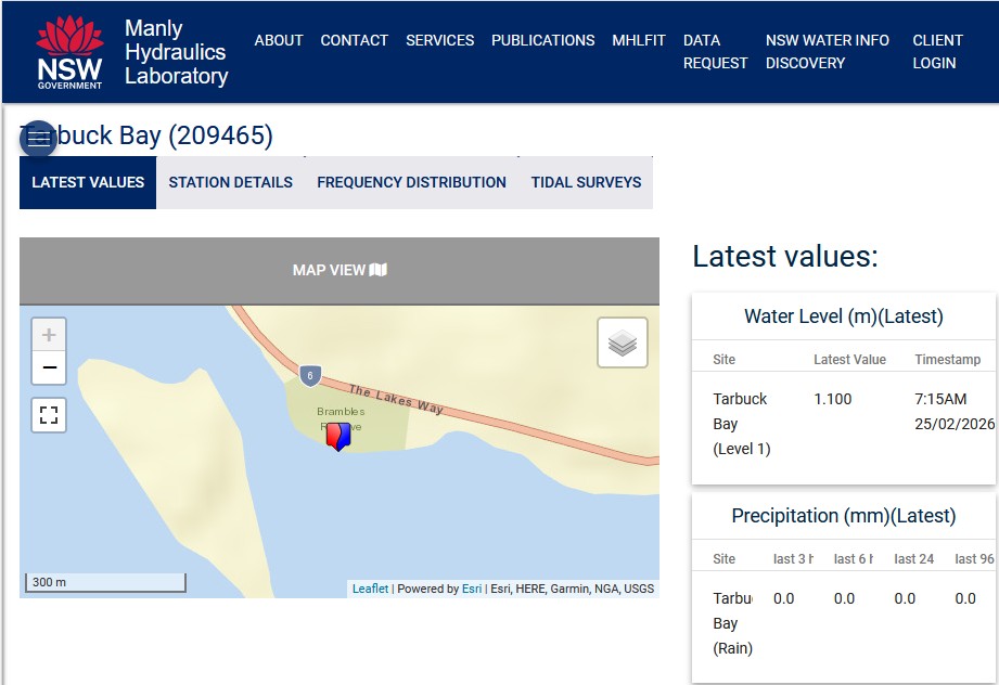
Smiths Lake is monitored 24 hours a day, seven days a week, by Manly Hydraulics Laboratory (MHL) under a NSW Government contracted program of continuous waterways measurement. The gauge station is located at Tarbuck Bay, and the live reading — recorded in metres Above Mean Sea Level (AMSL) — is publicly accessible online at any time, free of charge.
View the live Smiths Lake water level — MHL Tarbuck Bay, Site 209465 https://mhl.nsw.gov.au/Site-209465
We are currently seeking arrangements to link the Tarbuck Bay lake level monitoring site, to the Villagefirst website, to provide live feeds updating a table of information similar to the following.

Why the level matters
When heavy rain arrives — summer storms, east coast lows, or a sustained wet spell — the lake level becomes one of the most watched numbers in the village. Different members of the community watch it for different reasons.
Boat owners need time to move vessels clear of the sandbar area before an opening is announced. Foreshore and low-lying property owners monitor for flood risk as the level climbs toward the trigger. Fishermen plan around the timing and duration of an opening, which temporarily transforms the lake's character and fish movements. Holiday-makers want to know what the lake will look like on arrival — a high, brimming lake and a wide open entrance to the ocean is a very different experience from a calm, closed lagoon.
The trigger level and the decision to open
The trigger height for a mechanical opening is 2.1 metres AMSL, though this may be adjusted up or down depending on forecast weather conditions and tidal timing. As the water approaches this level, MidCoast Council monitors the gauge closely and consults with the Bureau of Meteorology before any decision is made. The timing of an opening is carefully planned to coincide with low tide, maximising the scouring effect and the outflow of water.
During an opening, the water can exit the lake with considerable force. Boat ramps are closed, access to Sandbar Beach is restricted to authorised personnel, and strong currents make the immediate area unsafe for swimming. Residents and visitors are advised to stay well clear of the opening point while work is underway.
The opening — what to expect
A lake opening is one of the more dramatic natural events in the life of Smiths Lake. Within hours of the trench being cut through the sandbar by earthmoving equipment, the lake level begins to drop visibly. The water rushes through the cut with force, scouring the channel and carrying the accumulated freshwater load of the catchment out to sea.
As the level falls, the lakescape changes noticeably. Shallow areas that were submerged become exposed. The foreshore widens. The water clears as the tidal exchange flushes nutrients and improves water quality throughout the estuary. Marine fish species that depend on the opening for spawning migrations move through the entrance — an event that draws keen interest from the local fishing community.
The entrance typically remains open for weeks to months, depending on wave and wind conditions, before sand movement naturally closes the channel again. As it closes, the lake transitions back to its predominant state — a calm, sheltered coastal lagoon — and the cycle begins again.
After the opening
In the days and weeks following a lake opening, residents and visitors often notice a marked improvement in water clarity and colour. The tidal exchange during an opening refreshes the estuary, reducing algal growth and improving conditions for fish, birdlife and aquatic vegetation. The foreshore also settles — as the lake returns to normal levels, the sandbar reforms and the beach regains its familiar character.
For many in the community, the period immediately after an opening — when the lake is clear, the level is comfortable, and the entrance has just closed — represents the lake at its very best.
Check the live level any time https://mhl.nsw.gov.au/Site-209465 — MHL Tarbuck Bay, Site 209465 Real-time data, updated continuously, free of charge.
Sources: Manly Hydraulics Laboratory https://mhl.nsw.gov.au/Site-209465 · MidCoast Council — Smiths Lake to be opened https://www.midcoast.nsw.gov.au/Your-Council/Our-news/News-releases/Smiths-Lake-to-be-opened · Great Lakes Advocate https://www.greatlakesadvocate.com.au/story/7437493/midcoast-council-monitoring-smiths-lake-water-levels/ · NSW Environment and Heritage https://www.environment.nsw.gov.au/topics/water/estuaries/estuaries-of-nsw/smiths-lake. Content compiled for Villagefirst.